We may earn a commission when you book through links on this page, at no extra cost to you. Read our affiliate disclosure.
- Summit
- About 2,500 m on the Polish border
- Round trip
- Around 8.5 to 9 hours
- Season
- June to October
- Difficulty
- Demanding, with chains
Diesen Reiseführer auf Deutsch lesen
Przeczytaj ten przewodnik po polsku
Přečtěte si tohoto průvodce česky
Olvassa el ezt az útmutatót magyarul
Rysy is a demanding mountain hike with scrambling, not a technical climb: around 8.5 to 9 hours return from Štrbské Pleso, with steep rocky sections protected by chains. Take hiking insurance from EKTA before you go, because mountain rescue can be costly and the route is serious for inexperienced walkers.
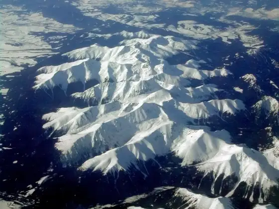
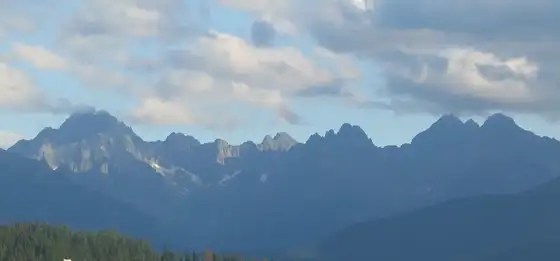
The summit is about 2,500 m on the border with Poland and is one of the best known peaks of the High Tatras. The higher trails in the Tatras are closed from 1 November to 31 May, so the realistic season runs from June to October. Slovakia's highest peak (Gerlachovský štít) is a different matter, and most visitors may only climb it with a certified mountain guide.
Below are the ways to prepare, the route, the difficulty and the safety points.
Top picks at a glance
Key takeaways
- Plan for around 8.5 to 9 hours return from Štrbské Pleso.
- The final section is steep and rocky, with fixed chains in places.
- The season runs roughly from June to October, because high trails are closed from 1 November to 31 May.
- Start early, because afternoon storms are common and the summit is crowded.
- Carry insurance that covers mountain rescue.
Best ways to prepare for the Rysy hike, ranked
Ranked by how well each option fits this trip: convenience, cost and who it suits. Some options are affiliate partners. How we rank
-
Our top pick1
Hiking insurance with EKTA
Best overallBest for: Anyone attempting Rysy
EKTA offers travel insurance quotes. For Rysy, check that the policy covers hiking at altitude and mountain rescue, and read the exclusions. Rescue costs can be significant, so confirm cover before you travel.
Official website Read our EKTA review- Covers medical costs abroad
- Peace of mind on a serious hike
- Check altitude limits
- Read exclusions
- Underwritten by an insurer licensed outside the EU (Union of Comoros); read the policy wording
-
2
Hike on your own from Štrbské Pleso
CheapestBest for: Experienced hikers
The standard route starts at Štrbské Pleso, passes Popradské pleso and climbs to Chata pod Rysmi before the final summit section. It is well marked, but the final part is steep and rocky.
- Free
- Flexible start time
- Navigation and weather are your responsibility
- Crowded in summer
-
3
Mountain guide
Best for first-timersBest for: Less experienced hikers
A licensed mountain guide can lead the route, advise on weather and help on the chains. Prices and availability vary, so ask local operators well ahead.
- Safer for beginners
- Local knowledge
- Costs more
- Needs booking
-
4
Overnight at Chata pod Rysmi
Best for a calmer startBest for: Hikers who want a split trip
Staying at the mountain hut near the summit shortens the summit day and avoids the crowd on the way up. Huts are limited and open in the season, so book well ahead and check the current rules.
- Shorter summit day
- Sunrise potential
- Limited beds
- Basic facilities
The route
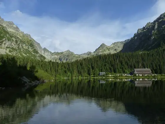
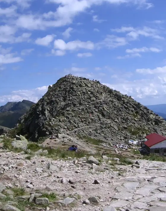
The hike starts at Štrbské Pleso, follows the marked path to Popradské pleso, then climbs towards Chata pod Rysmi, the hut below the summit. The final stage climbs steeply over rock, with fixed chains in places. The total is around 8.5 to 9 hours return for most walkers, though speeds vary. The other well-known climb from the same resort is covered in the Kriváň hike guide.
Step by step: the day on the trail
- Before dawn: check the forecast and the status of the high trails, eat well and fill your water bottles.
- Štrbské Pleso to Popradské pleso: the first leg is a steady, well-used path. Take it at an easy pace and save your energy.
- Towards Žabie plesá and the hut: the trail climbs through rocky terrain to Chata pod Rysmi, which stands at about 2,250 m. This is the natural place to rest and decide whether the weather and your legs allow the summit.
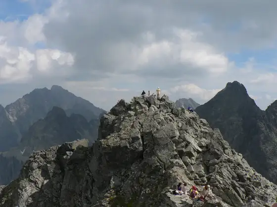
- The final climb: the last stretch is steep and rocky, with chains in places. Move steadily and keep three points of contact when the rock is wet.
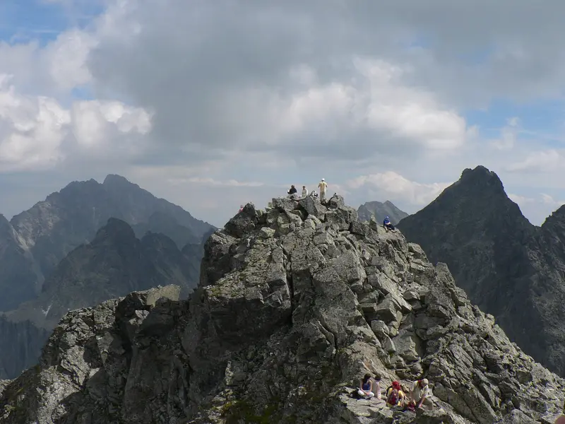
- Summit: Rysy has three peaks. The middle one is about 2,500 m, and the northwest one is the highest point in Poland.
- Descent: go down the way you came and give way on the chain sections. Most accidents on mountains happen on the way down when people are tired.
Difficulty and chains
Rysy is demanding. Expect a long day, steep ground and some exposed parts where you use chains. You need good fitness, sturdy boots and a head for heights. The summit is shared with Polish hikers who come from the other side, so the top can be crowded. In wet or icy conditions the rock becomes slippery and the route can be dangerous. If you would rather approach from the Polish side, Bratislava to Zakopane compares transfer, bus and train.
Is Rysy a hike or a climb? Trail accessibility
Rysy is a hike, not a rock climb. You do not need ropes, a harness or climbing skills, but the last section is steep, rocky and exposed in places, and you use your hands and the fixed chains to move up and down. That is scrambling, and it is why the route suits fit walkers with a head for heights rather than complete beginners.
- Walkers with experience: long days in the mountains, comfortable with steep ground and chains.
- Beginners: start with an easier walk first, such as Popradské pleso, then decide. See hiking in Slovakia for beginners.
- Children: only older, experienced and fit children, with an adult setting the pace and a turn-back time.
- Wheelchairs and pushchairs: the trail is not accessible. The path is rocky and narrow, and the upper part has chains.
- Dogs: check the national park rules first, see Slovakia with a dog.
If you want mountain scenery without the chains, easy hikes in the High Tatras and the lifts described in High Tatras cable cars give you a gentler day.
Season and closures
The high trails of the High Tatras are closed from 1 November to 31 May, which includes the route above Chata pod Rysmi. Plan the hike for summer or early autumn. Even in July, snow patches may remain early in the season, so ask at the hut or tourist office about current conditions. The Tatra trail season checker shows at a glance whether Rysy is open on the day you travel.
Slovak side or Polish side?
| Slovak side | Polish side | |
|---|---|---|
| Start | Štrbské Pleso | Morskie Oko |
| Character | Long, steady climb, then chains | More spectacular, but more exposed |
| Landmark on the way | Chata pod Rysmi | Czarny Staw |
| Best for | Hikers who want an easier approach | Experienced mountain walkers |
Most visitors based in Slovakia use the Slovak route, since you can reach the trailhead on the Tatra Electric Railway. Snow can last on the Polish side until the second half of June, so conditions there deserve extra care in early season.
What to pack and when to start
- Start early, ideally around sunrise, to avoid afternoon storms and crowds.
- Sturdy boots, a rain jacket, warm layers, gloves and a hat.
- Plenty of water and food. Prices at huts are higher.
- A helmet is useful on steep rocky sections where people above can kick stones.
- A charged phone. The emergency number is 112.
Common mistakes
- Starting late. Leaving after 8 or 9 a.m. in July means you reach the chains at the busiest time and meet the storms on the way down.
- Wearing trainers. Wet rock and loose stones need boots with grip.
- Ignoring the turn-back time. Summit fever is real. Decide the time before you set out and stick to it.
- Underestimating the length. Around 8.5 to 9 hours return is a full day with no margin for long breaks.
- Relying on phone signal. Download an offline map and carry paper if you can.
- Not checking the trail status. The high trails close from 1 November to 31 May, and the exact dates around the huts can differ, so check before you travel.
Alternatives and planning
If Rysy is too demanding, see best hikes in the High Tatras and the gentler walk to Popradské pleso. For transport see Poprad airport to the High Tatras. Read hiking insurance for the High Tatras for more on cover.
Getting to the start
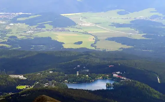
Štrbské Pleso is reached by the Tatra Electric Railway from Poprad or by road. Parking at the resort fills early in summer, so arrive before the day starts or use public transport. A pre-booked transfer works well if you want to start at dawn, since early trains may not match your plan. Read Košice to the High Tatras and Bratislava to the High Tatras for ways to arrive.
Weather and turn-back rules
Set a turn-back time before you start, for example when you reach the hut. Storms build in the afternoon, and rock with chains becomes dangerous when wet. If the forecast looks unstable, choose a lower hike instead. Do not follow a crowd upward if you feel unsafe, and give way to people descending on the chain sections.
Fitness and preparation
Treat Rysy as a full mountain day. Practise on long hikes with elevation gain before you go, and break in your boots. Sleep well the night before and eat a solid breakfast. Check the forecast the day before and again at the trailhead. If you have a fear of heights, the chain sections can feel exposed, so consider a guide or a different goal.
Polish side and borders
Rysy lies on the border between Slovakia and Poland, and hikers also climb it from the Polish side. The border is open and unmarked on the summit, but carry ID. The Slovak route from Štrbské Pleso is usually considered the quieter of the two, though it is still busy in July and August. Do not leave marked trails, and respect closures.
Where to stay and what else to do
Staying at the lake or in a resort makes an early start easy. Compare areas in where to stay in the High Tatras. If the weather turns, easier days in the area are covered in things to do in the High Tatras, or you can ride up to Hrebienok for an easy walk. For summer planning see High Tatras in summer.
Frequently asked questions
How long does the Rysy hike take?
Around 8.5 to 9 hours return from Štrbské Pleso for most walkers.
Are there chains on Rysy?
Yes. The final steep rocky part has fixed chains in places.
When is Rysy open?
Roughly June to October. High trails in the Tatras are closed from 1 November to 31 May.
Is Rysy suitable for beginners?
Not for inexperienced walkers. It is a demanding hike with exposed sections, so go with a guide or choose an easier route.
Do I need insurance for Rysy?
Insurance is strongly advised. Check that the policy covers hiking at altitude and mountain rescue.
How high is Rysy?
The summit is about 2,500 m. The northwest peak, on the Polish side, is the highest point in Poland.
Where is the hut on the Slovak route?
Chata pod Rysmi stands at about 2,250 m, below the summit. It is the usual rest stop before the final climb.
Is Rysy a climb or a hike?
It is a hike with scrambling. You do not need climbing gear, but the final section is steep and rocky, and you use fixed chains in places. Good fitness, sturdy boots and a head for heights matter more than technical skill.
Is the Rysy trail accessible for people with limited mobility?
No. The trail is long, rocky and steep, and the upper part uses chains. It is not suitable for wheelchairs or pushchairs. For gentler mountain views, choose a lift-assisted visit or an easy walk around the lakes.
Photo: Rysy · Krzysztof Dudzik-Górnicki (User:ToSter) · CC BY-SA 3.0