We may earn a commission when you book through links on this page, at no extra cost to you. Read our affiliate disclosure.
- Elevation
- About 2,494 m
- Gain
- About 1,150 to 1,360 m
- Trails
- Blue, green, red then blue
- Season
- Closed 1 Nov to 15 Jun
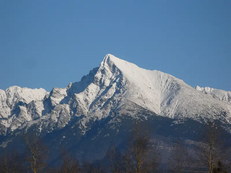
Kriváň is a 2,494 m peak in the High Tatras that you can hike on three marked trails, with the shortest ascent starting at Štrbské Pleso (red to Jamské pleso, then blue) and gaining about 1,150 m. Taply ranks hiking insurance with EKTA first, because the final rocky section is steep, weather turns quickly and a rescue can be billed.
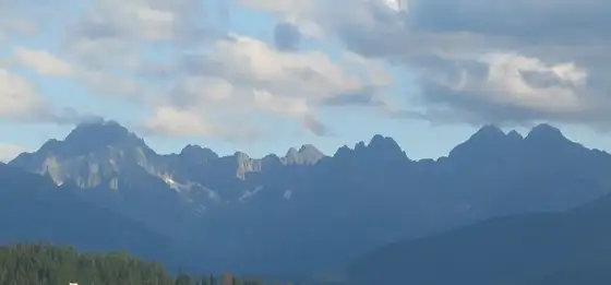
The mountain has long been a symbol in Slovak national culture, appears on the Slovak euro coins, and was historically considered a rival to Lomnický štít for the title of highest Tatra peak until measurements in 1793 settled the question. Today it is one of the most popular full-day hikes in the region, although it is not a beginner walk.
This guide covers the trails, a comparison table, how to reach the trailheads, the closed season and a safety checklist. For other options, see the best hikes in the High Tatras and easier walks.
Top picks at a glance
Key takeaways
- Kriváň is about 2,494 m. All routes converge near 2,145 m and finish with a steep rocky climb of about 350 m.
- The shortest ascent is from Štrbské Pleso via Jamské pleso, with a gain of around 1,150 m.
- Plan a full day. Start early and aim to be down before afternoon storms.
- Higher trails are closed from 1 November to 15 June.
- Mountain rescue is 18 300, and 112 also works.
Best ways to plan a Kriváň hike, ranked
Ranked by how well each option fits this trip: convenience, cost and who it suits. Some options are affiliate partners. How we rank
-
Our top pick1
Hiking insurance with EKTA
Best overallBest for: Anyone going above the huts
Kriváň is a long, steep day hike with a rocky summit section. EKTA is a travel insurance option to check for hiking cover and rescue costs before you set out.
Get a quote from EKTA Read our EKTA review- Online purchase before you travel
- Useful where a rescue bill is possible
- Check that alpine terrain and guided climbing are covered
-
2
Hike from Štrbské Pleso
Shortest gainBest for: Fit hikers on a day trip
Follow the red trail to Jamské pleso, then the blue trail to the summit. It is the shortest gain of the three routes, at about 1,150 m.
- Easy access by train
- Lakeside start
- Steep final section
-
3
Private transfer with Kiwitaxi
Best for early startsBest for: Groups and fly-in visitors
Kiwitaxi offers private transfers between cities and airports. A booked car from Poprad or the airport to the trailhead makes a 6 a.m. start realistic.
Book a transfer on Kiwitaxi Read our Kiwitaxi review- Early start
- Drop at Tri Studničky or Štrbské Pleso
- Extra cost
-
4
Tatra Electric Railway and trains
CheapestBest for: Budget travellers
Rail links reach Štrbské Pleso from Poprad. Check the first departure against your planned start time.
Official website- Low cost
- No parking
- Fixed timetable
The three trails compared
Three marked trails climb Kriváň, and they all join before the final ascent. Pick by where you stay and how much climbing you want.
| Trail | Start | Gain | Notes |
|---|---|---|---|
| Red then blue | Štrbské Pleso | About 1,150 m | Shortest, via Jamské pleso |
| Blue | Road between Štrbské Pleso and Pribylina | About 1,300 m | Classic route through the valley |
| Green | Tri Studničky | About 1,360 m | Joins the blue trail below the summit |
All three meet at about 2,145 m, followed by about 350 m of steep rocky ascent where you may need your hands for balance. The old miners' road is unmarked and off limits under park rules, so stay on the marked paths.
How long it takes
Allow a full day. Fit hikers usually need most of a working day for the round trip, and families or slower walkers should add a few hours and consider a shorter walk instead. The exact times depend on your starting point and conditions, so use the posted trail signs and plan a turn-back time rather than pushing for the top.
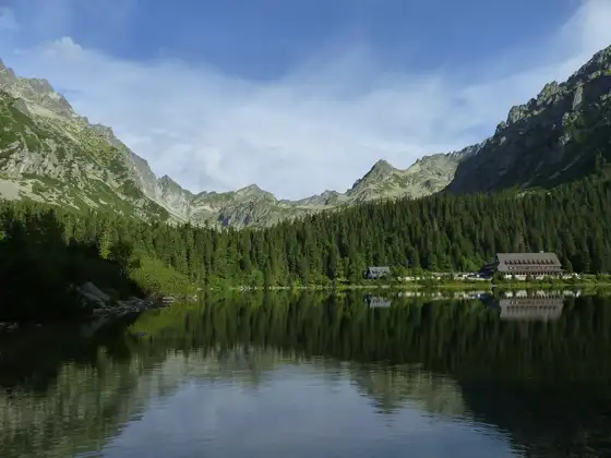
For something shorter, Popradské pleso and Štrbské Pleso offer lake walks without the summit effort.
Season and trail closure
Higher trails in Tatra National Park are closed from 1 November to 15 June, so Kriváň is a summer and early autumn hike. Snow may linger well into June, and early snow can return in autumn. Check TANAP for the current status before you travel, and avoid the peak after fresh snow unless you have winter equipment and experience.
Summer afternoon storms are the main hazard. Be off the ridge by early afternoon and turn back if clouds build. See High Tatras in summer for seasonal planning.
Getting to the trailheads
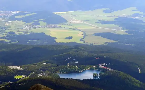
Štrbské Pleso is the easiest start by public transport: trains and the electric railway connect it with Poprad, and a booked transfer from Poprad-Tatry airport is quick. Tri Studničky and the road start are served by buses and car routes, so check timetables or arrange a lift. If you drive, see car rental in Poprad and expect busy parking on summer weekends.
Overnight stays in the Tatra resorts reduce the early-morning travel and give you the best chance of a clear start.
What to bring and safety
Carry at least two litres of water, food, a waterproof jacket, warm layer, sun protection, sturdy boots, a map or offline route and a charged phone. Poles help on the descent. Leave a plan with someone.
Mountain Rescue is 18 300, and 112 also works. Rescue can be billed, so read hiking insurance for the High Tatras before you go.
The final climb in detail
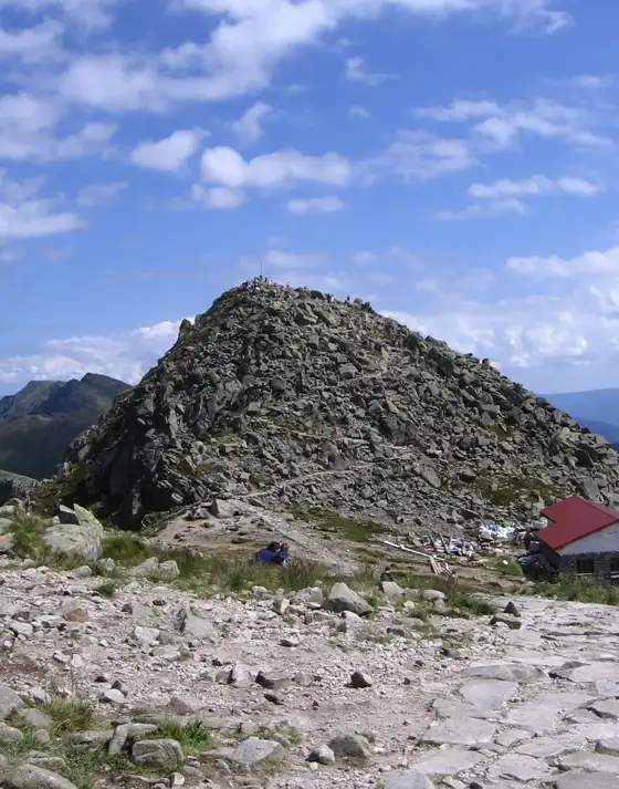
All three trails join at about 2,145 m, then climb roughly 350 m over steep rock to the summit. This is the hardest part: loose stones, short scrambles and exposure. Poles are less useful here than free hands. Choose your footing carefully and keep a distance from the hiker above you so you are not hit by falling stones.
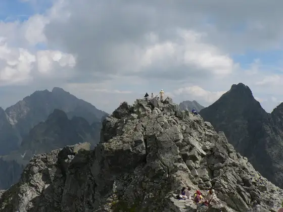
On a clear day the summit shows the Tatra ridge, the Podtatranská basin and the valleys on both sides. Because the mountain is a national symbol, expect a crowd on summer weekends, with a queue forming near the top. Be patient and give way on narrow sections. If the final part feels beyond you, turning back at the saddle is a safe and respectable decision, and the view from Jamské pleso is still excellent.
Descending is where tired hikers slip, so save energy for it. Take a break at Jamské pleso or a similar flat stretch, eat something, and drink before the long downhill. Knees take a beating on the loose lower sections, and trekking poles reduce the strain. If you started on one trail you can descend by another and arrange pickup at a different trailhead, but only if the transport is fixed in advance. Otherwise return the way you came, which is the simplest and safest plan, and keep your phone battery above half for navigation and emergencies.
Keep an eye on the time as well as the distance. A simple rule is to set a turnaround time before you start, such as early afternoon, and to respect it even if the summit looks close. Rockfall, cold wind and fading energy all build late in the day, and the mountain will be there next summer. Tell your accommodation which trail you chose and when you expect to be back, and carry a thin emergency blanket in your pack.
Choosing the best day and start time
The best days are stable, dry and cool, with no thunderstorm risk in the forecast. Midweek mornings are quieter than weekends. Start at first light in July and August so that you are off the summit by midday. September often brings clearer air and fewer people, though the days are shorter and the evenings cold.
Avoid a day with rain in the forecast, as wet rock is slippery and fog hides the markings. Check TANAP for current trail status, and plan accommodation in Štrbské Pleso or a nearby resort the night before. For a gentler first outing, see easy hikes in the High Tatras, or use a mountain hut stop to break up a longer trip.
Frequently asked questions
How high is Kriváň?
Kriváň is about 2,494 m high, in the High Tatras of northern Slovakia.
Which trail to Kriváň is shortest?
The red trail from Štrbské Pleso to Jamské pleso, then the blue trail, has the smallest gain at about 1,150 m.
Is Kriváň hard?
It is a strenuous day hike. The last section above about 2,145 m is steep and rocky, and hands may be needed for balance. It is not a beginner walk.
When is the Kriváň trail closed?
Higher Tatra trails are closed from 1 November to 15 June. Check TANAP for current conditions.
Why is Kriváň famous?
It has been a symbol in Slovak national culture for about two centuries and appears on Slovak euro coins.
What is the rescue number?
Call 18 300 for Mountain Rescue, or 112.
Photo: Kriváň (peak) · Achernar · CC BY-SA 3.0