We may earn a commission when you book through links on this page, at no extra cost to you. Read our affiliate disclosure.
- Where
- Northern Slovakia and southern Poland
- Length
- About 57 km in a straight line
- Highest peak
- Gerlachovský štít, 2,655 m (Slovakia)
- Share in Slovakia
- About 78% of the area
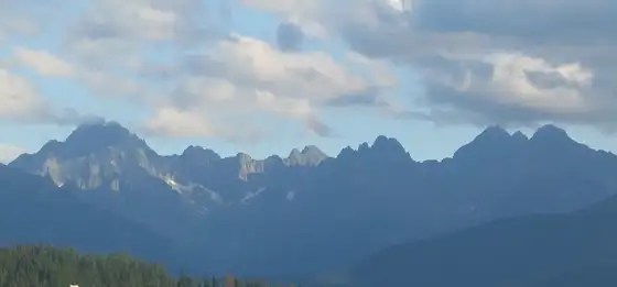
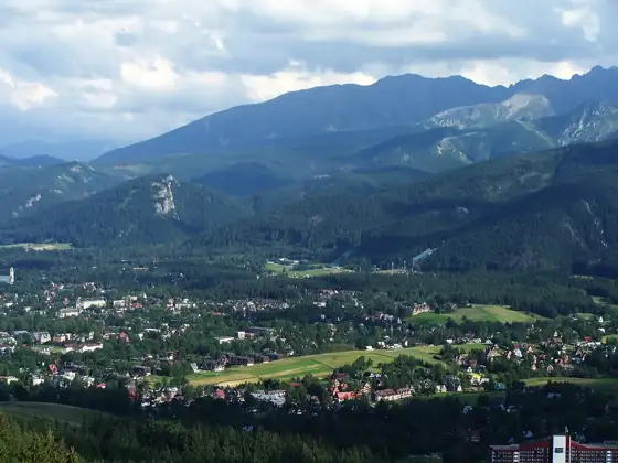
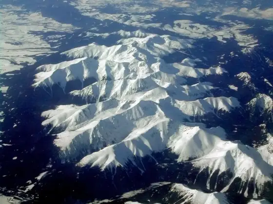
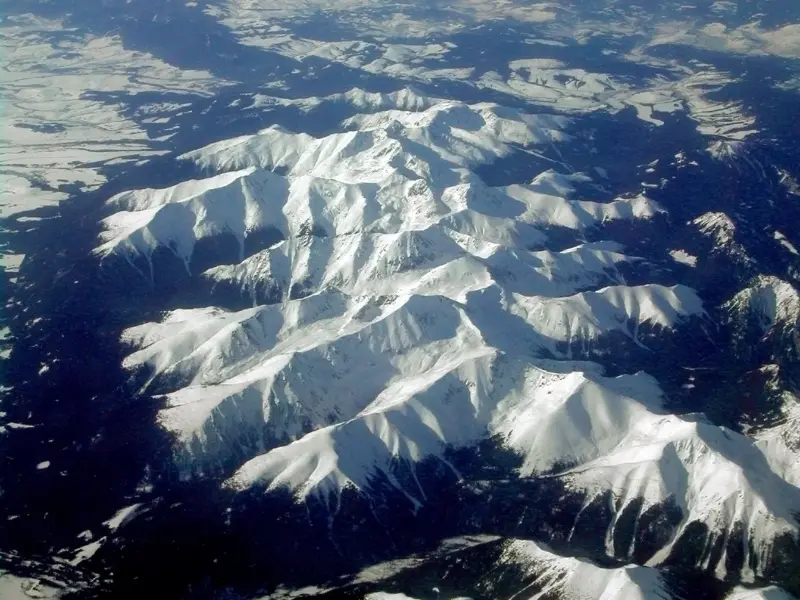
The Tatra Mountains are the highest part of the Carpathians, a compact range on the border of northern Slovakia and southern Poland, and the easiest way to reach them from a distant airport is a pre-booked private transfer such as Kiwitaxi to a base like Starý Smokovec or Zakopane. Roughly three quarters of the range lies in Slovakia, including the highest peak, Gerlachovský štít at 2,655 metres. The rest is in Poland, where Zakopane is the main town.
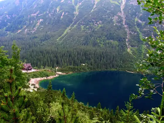
Searches for "Tatra Mountains Poland" and "Tatra Mountains Slovakia" describe the same mountains from two sides. The Slovak side has the taller, more rugged High Tatras, resorts at around 1,000 to 1,350 metres and a railway linking them. The Polish side has the lively town of Zakopane and easy access to well-known spots such as Morskie Oko.
This page is the overview of the whole range. For a detailed resort-by-resort plan on the Slovak side, see the High Tatras travel guide.
Top picks at a glance
Key takeaways
- About three quarters of the Tatras are in Slovakia, including the highest peak, Gerlachovský štít (2,655 m).
- The range has three parts: High Tatras, Western Tatras and Belianske Tatras. The Low Tatras are a separate range to the south.
- Slovakia has three resorts linked by rail (Štrbské Pleso, Starý Smokovec, Tatranská Lomnica). Poland has Zakopane.
- Many Slovak trails above the huts close in winter, from 1 November until late spring. The Polish side has no equivalent fixed closure, but trails can be closed for avalanche risk.
- Rysy is the highest point of Poland and sits on the border, so it can be climbed from either country.
Best ways to get to the Tatra Mountains, ranked
Ranked by how well each option fits this trip: convenience, cost and who it suits. Some options are affiliate partners. How we rank
-
Our top pick1
Private transfer with Kiwitaxi
Best overallBest for: Families and groups arriving by air
Kiwitaxi offers private transfers between cities and airports, so you can book a car from Kraków, Poprad-Tatry, Košice or Vienna to a Tatra base. The mountains are far from most big airports, and a fixed-price ride with luggage or ski gear avoids several changes.
Book a transfer on Kiwitaxi Read our Kiwitaxi review- Door-to-door, no changes with luggage
- Works for either the Slovak or the Polish side
- Price is agreed before you travel
- Costs more than a train or coach
- Needs a booking in advance
-
2
Trains and the Tatra Electric Railway
Cheapest on the Slovak sideBest for: Budget travellers staying in the Slovak resorts
Trains reach Poprad, and a separate electric railway links the Slovak resorts. It is the standard car-free way to move around the Slovak side.
Official website- Low fares
- Frequent in season
- No parking needed
- Fixed timetables
- Does not reach Zakopane
-
3
Rental car with Auto Europe
Best for flexibilityBest for: Two-country road trips
A car makes it simple to visit both sides in one trip and to reach trailheads and villages. Auto Europe is a booking site where you can compare rental options.
Compare cars on Auto Europe Read our Auto Europe review- Easy to cross between Slovakia and Poland
- Good for ski luggage
- Your own schedule
- Paid parking at popular trailheads
- Winter mountain roads need care
-
4
Flights with Aviasales
Best for finding flightsBest for: Travellers comparing entry airports
Aviasales compares flight prices, which helps when choosing between Kraków, Poprad-Tatry, Košice and other airports as your entry point.
Compare flights on Aviasales Read our Aviasales review- Compares many airlines
- Helps you pick the cheapest entry airport
- You still need ground transport to the mountains
- Routes into Poprad-Tatry are limited
-
5
Long-distance coaches
Budget alternativeBest for: Solo travellers on a budget
Coach operators serve Poprad and Zakopane from larger cities. Timetables and operators change, so check them when you plan.
Official website- Often cheaper than a transfer
- Direct options exist on some routes
- Fixed times
- Slower with heavy luggage
Where the Tatras are and how big they are
The Tatras run roughly east to west along the Slovak-Polish border, about 57 kilometres in a straight line and around 19 kilometres wide. They are the highest range of the Carpathians, and compact enough to cross in a day. Of the roughly 785 km² of the range, about 78% is in Slovakia and about 22% in Poland.
The range has three parts. The High Tatras are the central, alpine core with the highest peaks, glacial lakes and the best-known resorts. The Western Tatras are lower and greener, with rounded ridges and more forest. The Belianske Tatras are a short limestone section in the east, generally quieter than their neighbours.
The Low Tatras are a different range. They lie south of the Liptov valley, entirely in Slovakia, and are known for the ski area around Jasná. See Jasná in the Low Tatras if you want gentler mountains.
Highest peaks and the Rysy border point
The highest peak of the Tatras is Gerlachovský štít at 2,655 metres, entirely in Slovakia. It is a technical climb that normally needs a mountain guide, so read the Gerlachovský štít guide before planning it.
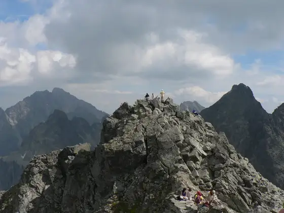
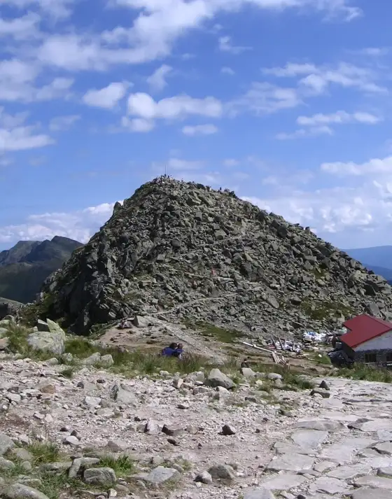
Rysy is the highest point of Poland, at about 2,500 metres, and it sits on the border. Some sources give 2,499 metres after a map revision. You can climb it from the Slovak side via the Popradské pleso valley or from the Polish side via Morskie Oko. See the Rysy hike guide and Morskie Oko from Slovakia.
Slovak side vs Polish side
The two sides feel different, even though the mountains are the same range. The table sums up the main contrasts.
| Factor | Slovak side | Polish side |
|---|---|---|
| Share of the range | About 78%, including the highest peaks | About 22% |
| Main bases | Štrbské Pleso, Starý Smokovec, Tatranská Lomnica, Poprad | Zakopane |
| National park | TANAP, founded 1949 | TPN, founded 1954 |
| Character | Small mountain resorts, quiet evenings | A busy town with shops, restaurants and nightlife |
| Getting around | Tatra Electric Railway links the resorts | Buses and minibuses; a cable car to Kasprowy Wierch |
| Winter trail closures | Most trails above the huts closed from 1 November until late spring | No fixed seasonal closure; trails can close for avalanche risk |
| Nearest airports | Poprad-Tatry, Košice | Kraków, Katowice |
National parks: TANAP and TPN
Both sides are protected. The Slovak Tatra National Park (TANAP) was founded in 1949 and covers about 738 km². The Polish Tatra National Park (TPN) was founded in 1954. The two parks together form a transboundary biosphere reserve.
Park rules apply on both sides: stay on marked trails, no wild camping, and expect rules on dogs and drones. Check the official park websites for current regulations and any entry ticket on the Polish side before you go.
Seasonal trail closures
On the Slovak side, marked trails above the mountain huts are closed in winter, starting on 1 November. Official TANAP information lists the end date as 31 May, while older guidance and many guidebooks quote 15 June, so check the current date on the TANAP site. Trails leading to the huts stay open all year, with the exception of the hut below Rysy. Closed trails are not a loophole for experienced hikers; the rule is enforced and fines apply.
On the Polish side, no fixed seasonal closure date applies in the same way. Closures happen when conditions demand it, for example during high avalanche risk, and some routes change by season. Check the TPN site and local avalanche information before any winter or spring trip. Hikers heading up from either side should also read the best hikes in the High Tatras and consider hiking insurance for the High Tatras, since mountain rescue is not always free.
How to get to the Tatra Mountains
For the Slovak side, the nearest airport is Poprad-Tatry, followed by Košice. Read the Poprad airport to High Tatras guide. For the Polish side, Kraków is the usual gateway for Zakopane, which is around two hours by road.
Travellers coming from Vienna or Budapest typically fly or drive to Slovakia and continue by road or rail. The longer routes from Bratislava are covered in Bratislava to Zakopane, and the link from Poland to Slovakia in Kraków to the High Tatras. Many visitors fly into Kraków and cross into Slovakia by transfer.
Which side suits which traveller
- First-time hikers and families: the Slovak side. Resorts, lifts and the railway make short walks easy, and the High Tatras guide shows how to plan them.
- Serious alpine hikers: the Slovak side, which has the highest peaks and the most huts. Mind the winter closure.
- Nightlife, shopping and a town atmosphere: Zakopane on the Polish side.
- Skiers: both sides have ski areas, with Zakopane suiting a lively trip and the Slovak resorts a quieter one.
- Hikers who want both: base on one side and cross over for a day. Rysy and Morskie Oko are the classic border trips.
Frequently asked questions
Are the Tatra Mountains in Poland or Slovakia?
Both. The Tatras run along the border, with about three quarters of the range in Slovakia and the rest in Poland. The highest peak, Gerlachovský štít at 2,655 metres, is in Slovakia.
What is the difference between the High Tatras and the Tatra Mountains?
The High Tatras are the central, highest part of the Tatra Mountains. The range also includes the Western Tatras and the Belianske Tatras.
Are the Low Tatras part of the Tatra Mountains?
No. The Low Tatras are a separate range south of the Liptov valley, entirely in Slovakia.
Which side of the Tatras is better, Slovakia or Poland?
The Slovak side has the higher peaks and quieter resorts linked by rail. The Polish side has Zakopane, a livelier town with more nightlife and shops.
What is the highest point in the Polish Tatras?
Rysy, at about 2,500 metres, is the highest point of Poland. It sits on the Polish-Slovak border.
When are Tatra trails closed?
On the Slovak side, trails above the huts are closed from 1 November until late spring. Check the TANAP site for the exact end date. Polish trails can close for avalanche risk.
Photo: Tatra Mountains · Piotr J · CC BY 2.5